This month, let’s check out elephants that plough, prehistoric paintings and fabulous viewpoints, then spend some time unwinding on a peaceful lake in Hot District (so hot right now). Citylife has worked with the Tourism Authority of Thailand (TAT) to publish a book on road trips in the north, so here we go!
Hot District (Tel. 053 461 111) is so named because it means “to have arrived” and it is believed that the Lord Buddha arrived here many years ago. There is also evidence of pre-historic settlement in this area. It is located in the Southern part of Chiang Mai Province, past Hang Dong, about two hours south of the city.
Our first recommended route will take you on Route 108 via Hang Dong, Sanpatong, and Chom Thong Districts. Upon arrival in Hot, take the right turn at the roundabout towards Omkoi. Continue on until you come across Ob Luang
(Tel. 081 6021290 or bluang@fca16.com), a dramatic gorge with a gushing river flowing through it. Here you can take nature walks as well as explore ancient pre-historic wall paintings and see the remains of ancient settlements.
Continue 45 kilometres past Omkoi to visit Baan Na Kien (GPS 17.852187, 98.156460), where Karen hill people still use elephants to plough their fields. The road is rather rough, especially in the monsoon months, but once there you can truly relax, as you will be surrounded by stunning scenery. During the rainy months the villagers hold a very special rice ploughing ceremony where they will bring their elephants and, together, plough all the fields.
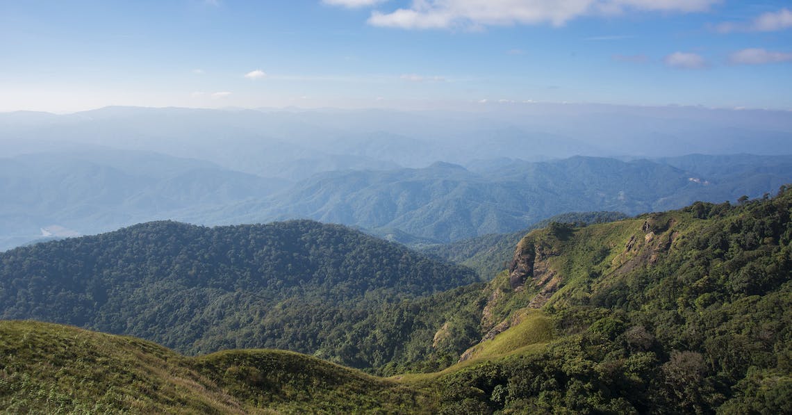
Return to Omkoi to visit the Doi Mon Chong Viewpoint (www.doimonjong.com, GPS 17.568839, 98.524275) by driving to Ban Yang Piang (GPS 17.778749, 98.492545) where the Muser hill people live. If you have a four wheel drive or some serious leg power (and are feeling adventurous), you can then climb up the mountain to see the Omkoi Wildlife Sanctuary (Tel. 053 467 109, GPS 17.589786, 98.527279). A further four hour trek will take you to the spectacular Hua Singh Viewpoint at 1,929 metres above sea level, where rhododendrons bloom in winter.
The second route takes you beyond the roundabout in Hot, about 15 kilometres towards Doi Tao. Before arrival at Ban Dong Dam (GPS 18.106497, 98.629524), you will see Pha Wing Chu to the right hand side, a mountain ridge with jutting earth formations running along the banks of the Ping River for around 250 metres and towering over the plains beyond at 25 metres, offering stunning views of the river and the plains as well as Doi Pui and Doi Luang mountains in the distance.
After leaving Baan Dong Dam, continue on to Doi Tao Lake (GPS 17.944509, 98.642418), which came into being following the building of Bhumibol Dam (Tel. 055 881211 ext. 15, GPS 17.242500, 98.972244) further downstream. Villagers were forced to relocate from the flooded areas and today the lake is a favourite spot for visitors to rent a houseboat or simply sit on pontoons by the lake’s edge dining on freshly caught fish.